วันพุธที่ 7 กรกฎาคม พ.ศ. 2553

Thung Salaeng Luang National Park Phitsanulok - ทุ่งแสลงหลวง พิษณุโลก


Thung Salaeng Luang National Park is a national park located in the Phitsanulok and Phetchabun Provinces of Thailand. It encompasses substantial portions of Amphoe Wang Thong and Amphoe Lom Sak.


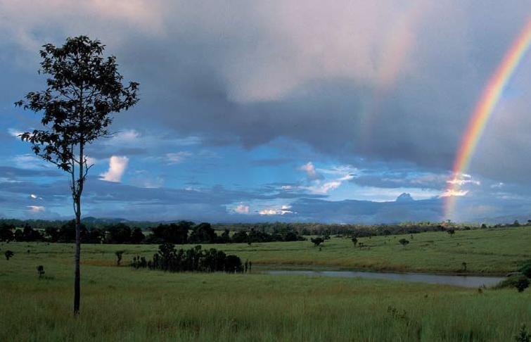
The park consists of limestone hills, slate and hardpan at altitudes ranging from 300 to 1,028 meters. Thung Salaeng Luang is inlaid with meadows, especially in the southern portions of the park. The park is also the source of numerous streams. There are large salt licks at Pong Sai in the north-west and Pong Thung Phaya in the south-west. the Wang Thong River flows through the park.


The park's forest is primarily classified as deciduous, with lowland scrub and tropical broadleaved evergreen covering smaller areas.

The average annual temperature is 25°C, although temperatures often reach 30°C during late spring and early summer. The average annual rainfall is 1.7 meters.


Thung Salaeng Luang was proposed for inclusion in the national parks system In 1959. Thung Salaeng Luang was declared a national park in 1972. From the late 1960s to the early 1980s, the park's forest was used as a major base for guerrillas of the Communist Party of Thailand.


Thung Salaeng Luang National Park is home to the Kaeng Song Waterfall, (or Namtok Kaeng Sopha) which is a three-tiered waterfall of the Wang Thong River. Shaped like a stairway, Kaeng Sopha is the largest waterfall in Phitsanulok, and it has been dubbed the Niagara Falls of Thailand. The torrents are very strong in the rainy season. The vapor rising in the area creates a vast rain-like curtain. Kaeng Sopha is the subject of a June, 2007 postage stamp in Thailand in the Thailand Waterfall series.

วันพุธที่ 23 มิถุนายน พ.ศ. 2553

LUANG PHA WIANG CAVE Lamphun - ถ้ำหลวงผาเวียง ลำปาง


Is one of Northern Thailand's largest caves and by far one of the most
interesting.

I had the pleasure of visiting this cave with the previous governor prior
to it's official opening. Since then, I had the pleasure of returning on
at least three more occasions. Although I am not an avid "plunker" I have
found this cave with its stalagmites and stalactites to be very
interesting and beautiful as have all the people I have taken there.

The Luang Phawieng cave is located about 45 minutes from Lamphun and just
past Ban Hong. ( a good day trip out of Chiang Mai, Thailand) As you leave
the main road you will travel on a dirt road that runs through a rock
quarry. This road runs across a stream and you are at the cave site. You
will find food and drink available in the parking area. Accessibility to
the cave has been one of the reasons in the past, that it has not been
developed into a tourist attraction although it was discovered about 400
years ago.


Legend says that this cave was carved out of the hillside approximately
500 million years ago and a noted place in the past for the robbers of the
area to stash their booty, as well at certain periods a storage area for
the Lanna royalty to store their gems. It also has been and still is a
favorite place for Thai monks as they journey to stop and rest overnight,
or for a day or two of meditation.

In comparison to the Cave at Chiang Dao which may leave you, feeling a
little claustrophobic the Tham Luang Pha Wiang cave is an open and
spacious cave. There are some bats but not too many.

The "shimmering curtain" and "precious stones" are highlighted buy signs
at present only in Thai. There is a total of 9 chambers in the cave. There
are guardrails present where need. The stalagmites and stalactites are in
a continual state of creating this natural scene.


If you're going to visit this cave you should dress appropriately and be
prepared to pace yourself. It is a fifteen minute climb to the top of the
hill in order to enter the cave. You should also carry a bottle of water.
There is a handrail along the path to the top to help those individuals
who need that little extra boost.

วันเสาร์ที่ 28 พฤศจิกายน พ.ศ. 2552

Doi Tung - Chiang Rai / ดอยตุง - เชียงราย


Known by locals as Thailand’s Switzerland, Doi Tung (‘Flag Mountain') is an attractive mountain-top destination of forests and nearby Shan, Akha and Lahu tribal villages. Probably the most important attraction in the area is Wat Phrathat Doi Tung – a temple built one thousand years ago which is an important place of pilgrimage for Buddhists from Thailand and overseas. A giant flag was flown from the point where the temple’s chedis were built giving 'flag mountain' its name. Doi Tung is also home to the Doi Tung Development Project, an initiative of Her Royal Highness Srinakarindra the Princess Mother (mother of Thailand’s current monarch) who passed away in 1995.


Doi Tung has traditionally been an area at the centre of Thailand’s opium production, and with a ready supply of the drug in the area, drug use was prevalent, especially amongst the poor. The Princess Mother built a summer palace in the area and initiated the Doi Tung Development Project.


The purpose behind the project was to establish means of overcoming the area’s social problems through education, training, and through “Sustainable Alternative Development” such as changes in agriculture (an Agricultural Training Centre was set up to help people change from opium production to growing crops such as coffee, strawberries and macadamia nuts) and the introduction of trade in such items as local handicrafts (a ‘Cottage Industry Centre’ was also set up alongside an outlet for locally produced goods and to ensure local crafts such as hand carpet manufacturing are passed on to future generations.


The Princess Mother’s palace has been maintained exactly as it was when she stayed there. The grounds of the palace (Mae Fa Luang Garden) are extremely well kept and certainly warrant a visit. Visits to the Doi Tung Development Project’s various activities are also possible.


A trip to Doi Tung is often combined with a visit to Mai Sai. Probably the biggest draw to the region is its scenery. A trip through the mountains to Doi Tung is simply glorious. Hiking here is possible, but you should always arrange a guide – drug production does still exist and the Mong Thai Army and Karen Rebels are occasionally active in the area.


How to get there: The palace is located at kilometre 12 of route 1149. Given the distances to be covered and the fact a motor vehicle is essential to a trip to Doi Tung, an organised tour to the site is recommended.


Contact:
Doi Tung Development Project
(053) 767-003, (053) 767-015-7